Being an avid camper and hiker in Texas means adding Guadalupe Peak to the Bucket List. It is considered the “Top of Texas” since it is the highest elevation point at 8,751 feet with amazing 360-degree views. A part of the National Park System that includes Carlsbad Canyon and Guadalupe Mountains National Parks, Guadalupe Peak’s trailhead sits off of Pine Springs Campground where there are RV, tent and primitive hike in camping available. No campsites have water or electricity, although there is a shared water facet within the campgrounds.
We hiked early in the day, prior to sunrise, and started with headlamps. Being the forgetful hiker I am, I forgot my headlamp and my hiking poles. I brought a small battery powered lantern that I hung by its handle for light. I made it through the hike without the poles, but I highly recommend them. Don’t be like me, create a checklist to help remember your gear every time. Here is a list of what I recommend bringing on this hike:
- Backpack with water bladder and 3L or more of water
- Sunscreen
- Chapstick
- Hiking Poles
- Headlamp
- Snacks
- Electrolytes
- Warm or sun hat and gloves
- Wind jacket and/or sunshirt
- Pants with pockets
- Toilet Paper
- Phone
- Hiking boots (I recommend mid-height)
- Socks that have been previously tested
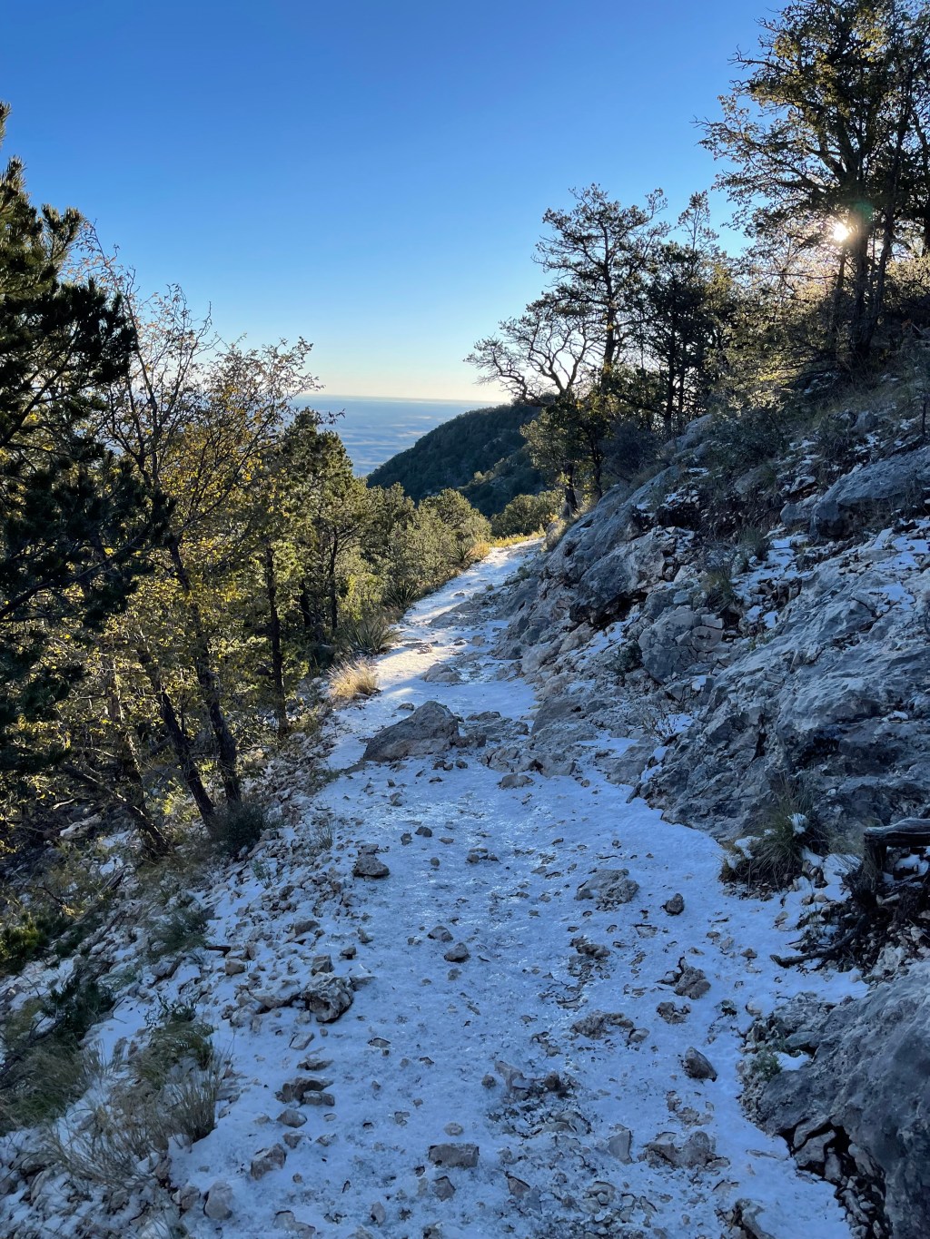
The sunrise was amazing once we arrived at the first summit, around Stock Trail junction. Since the surrounding terrain appears flat from that elevation, it seems the sun is everywhere but still cannot be seen. Next came the ice, left over from yesterday’s snowstorm. It had rained during the entire drive there and there were no indications that it snowed at the campsites. The snow and ice really surprised me as this was only the third week in October. It was also extremely windy when we came across the northern side of the mountain. I did not bring a wind jacket and wished I had. Overall, layers were the key to the day, when on the southern side of the mountain I started sweating.
Guadalupe Peak Trail is a false summit queen. When I came upon “Around the Bend,” I was sure that we were near the top, it could not go any higher, but there was more uphill climb. This happens a few more times. On the way down there were others who were starting their journey that would ask, “Is that the top?”, so it was comforting to know what we weren’t the only ones that had been fooled.
There is one really sketchy part near the top, walking over hanging rocks with a view over a cliff. My hiking partner had a near anxiety attack and did not remember that portion on her previous hike of G.P. Since I have a way of putting my foot in my mouth said, “maybe some of the rocks fell down since the last time.” She proceeded to tell me to, “not say that again.” On the way down, due to the change of view, that portion is not as frightening.
The top, with the American Airlines monument, is exciting to get to and the views are amazing. The winds are fierce up there, so we did not stay long. I was excited to be now doing the descent, since the air had been thin the last 1,000 feet of elevation. This required me to make more rest stops. The descent was when I really wish I had not forgotten my poles. The last 1.5 miles were especially tough as that is where a majority of the elevation change occurs. My partner gave me one of her poles which helped tremendously.
The entire hike took us six hours for the 8.4 miles. I was glad to have a partner and I am glad to mark this hike off my bucket list. I would like to go back and also visit Carlsbad Cavern. I recommend others prepare by hiking longer distances and do not be afraid to get to the top to get that photo with the pyramid. The hike is definitely something that can be accomplished for those that are determined.
